![](/images/other/stat-length.png)
![Excursión Senderismo La Croix-aux-Bois - Forêt de la Croix aux Bois - Photo](https://media.geolcdn.com/t/1900/400/ext.pjpeg?maxdim=2&url=https%3A%2F%2Fservices.sitytrail.com%2FGeolivesWS%2FDownloadMedia.ashx%3FTrailID%3D129652%26Media%3D13179_5.jpg)
Forêt de la Croix aux Bois
tracegps
Usuario
![Longitud](/images/other/stat-length.png)
Longitud
16,1 km
![Altitud máxima](https://static1.geolcdn.com/siteimages/upload/files/1508320355ic_sort_altitude_max_24dp.png)
Altitud máxima
243 m
![Desnivel positivo](https://static1.geolcdn.com/siteimages/upload/files/1508320355ic_sort_den_pos_24dp.png)
Desnivel positivo
273 m
![Km-Effort](/images/other/stat-length.png)
Km-Effort
19,7 km
![Altitud mínima](https://static1.geolcdn.com/siteimages/upload/files/1508320355ic_sort_altitude_min_24dp.png)
Altitud mínima
155 m
![Desnivel negativo](https://static1.geolcdn.com/siteimages/upload/files/1508320355ic_sort_den_neg_24dp.png)
Desnivel negativo
271 m
![Boucle](https://static1.geolcdn.com/siteimages/upload/files/16400158638029165_repeat_loop_refresh_sync_direction_icon.png)
Boucle
Sí
Fecha de creación :
2014-12-10 00:00:00.0
Última modificación :
2014-12-10 00:00:00.0
![Senderismo](https://static1.geolcdn.com/sitytour/trail-icons/101.png)
3h00
Dificultad : Medio
![Escanee este código QR para abrir la excursión en la aplicación SityTrail](https://capi.geolives.com/qq0zvz2zws4bq2lad0pu/sitytour/trails/129652/qr.png?size=200)
Aplicación GPS de excursión GRATIS
A propósito
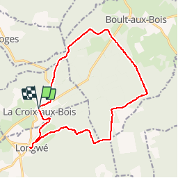
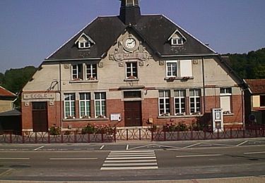
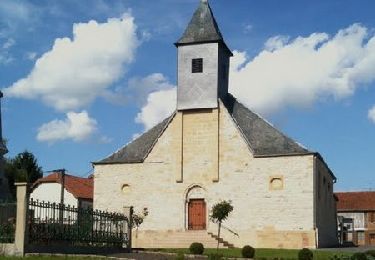
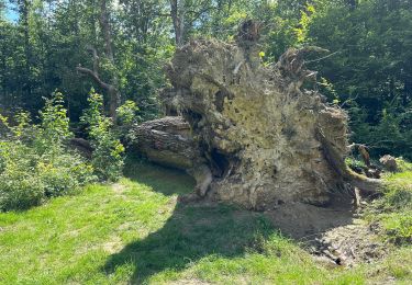
Ruta Senderismo de 16,1 km a descubrir en Gran Este, Ardenas, La Croix-aux-Bois. Esta ruta ha sido propuesta por tracegps.
Descripción
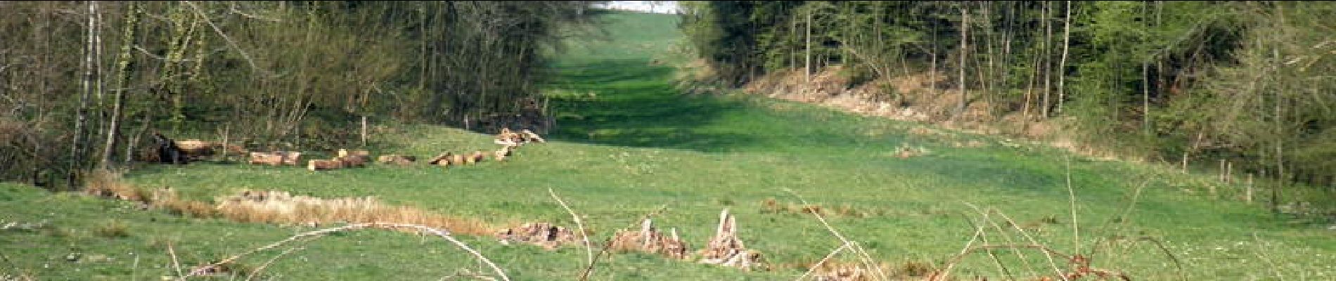
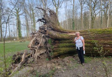
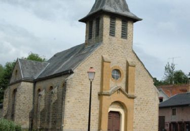
Pour ceux qui aiment la forêt c'est une balade idéale. Ne pas oublier de s'arrêter au gros chêne qui, bien que gros (6m48) est très élancé. Faire un tour dans Longwé, village encaissé avec de jolies maisons d'Argonne.
Localización
País:
France
Región :
Gran Este
Departamento/provincia :
Ardenas
Municipio :
La Croix-aux-Bois
Localidad:
Unknown
Salida:(Dec)
Salida:(UTM)
630057 ; 5473727 (31U) N.
Comentarios
Excursiones cerca
![Excursión Senderismo Boult-aux-Bois - Projet AA Boult aux bois](https://media.geolcdn.com/t/375/260/d40d4cc3-566e-430c-9fc1-38aee142d01e.jpg&format=jpg&maxdim=2)
![Senderismo Senderismo](https://static1.geolcdn.com/sitytour/trail-icons/101.png)
Projet AA Boult aux bois " Sentier des Templiers "
Senderismo
Difícil
Boult-aux-Bois,
Gran Este,
Ardenas,
France
![](/images/other/stat-length.png)
10,2 km | 12,8 km-effort
2h 54min
![](https://static1.geolcdn.com/siteimages/upload/files/16400158638029165_repeat_loop_refresh_sync_direction_icon.png)
Sí
![Excursión Senderismo Ballay - Le tour de Toges - Ballay - Photo](https://media.geolcdn.com/t/375/260/ext.jpg?maxdim=2&url=https%3A%2F%2Fservices.sitytrail.com%2FGeolivesWS%2FDownloadMedia.ashx%3FTrailID%3D172274%26Media%3D13590_1.jpg)
![Senderismo Senderismo](https://static1.geolcdn.com/sitytour/trail-icons/101.png)
Le tour de Toges - Ballay
Senderismo
Medio
Ballay,
Gran Este,
Ardenas,
France
![](/images/other/stat-length.png)
12,5 km | 14,8 km-effort
3h 0min
![](https://static1.geolcdn.com/siteimages/upload/files/16400158638029165_repeat_loop_refresh_sync_direction_icon.png)
Sí
![Excursión Senderismo Ballay - Les Bois de Landéves - Ballay - Photo](https://media.geolcdn.com/t/375/260/ext.jpg?maxdim=2&url=https%3A%2F%2Fservices.sitytrail.com%2FGeolivesWS%2FDownloadMedia.ashx%3FTrailID%3D172272%26Media%3D13587_1.jpg)
![Senderismo Senderismo](https://static1.geolcdn.com/sitytour/trail-icons/101.png)
Les Bois de Landéves - Ballay
Senderismo
Medio
Ballay,
Gran Este,
Ardenas,
France
![](/images/other/stat-length.png)
9,6 km | 12,3 km-effort
2h 30min
![](https://static1.geolcdn.com/siteimages/upload/files/16400158638029165_repeat_loop_refresh_sync_direction_icon.png)
Sí
![Excursión Senderismo Quatre-Champs - La forêt de Vandy - Quatre Champs - Photo](https://media.geolcdn.com/t/375/260/ext.jpg?maxdim=2&url=https%3A%2F%2Fservices.sitytrail.com%2FGeolivesWS%2FDownloadMedia.ashx%3FTrailID%3D172271%26Media%3D13585_1.jpg)
![Senderismo Senderismo](https://static1.geolcdn.com/sitytour/trail-icons/101.png)
La forêt de Vandy - Quatre Champs
Senderismo
Medio
Quatre-Champs,
Gran Este,
Ardenas,
France
![](/images/other/stat-length.png)
10,4 km | 13,4 km-effort
3h 0min
![](https://static1.geolcdn.com/siteimages/upload/files/16400158638029165_repeat_loop_refresh_sync_direction_icon.png)
Sí
![Excursión Senderismo Boult-aux-Bois - 2024 06 Boult au bois t1 - Photo](https://media.geolcdn.com/t/375/260/46e42a26-d7a3-43ac-95b1-04437c859b4d.jpg&format=jpg&maxdim=2)
![Senderismo Senderismo](https://static1.geolcdn.com/sitytour/trail-icons/101.png)
2024 06 Boult au bois t1
Senderismo
Muy difícil
Boult-aux-Bois,
Gran Este,
Ardenas,
France
![](/images/other/stat-length.png)
49 km | 57 km-effort
3h 29min
![](https://static1.geolcdn.com/siteimages/upload/files/16400158638029165_repeat_loop_refresh_sync_direction_icon.png)
No
![Excursión Senderismo Toges - Les Tasséniéres - Photo](https://media.geolcdn.com/t/375/260/ext.jpg?maxdim=2&url=https%3A%2F%2Fstatic1.geolcdn.com%2Fsiteimages%2Fupload%2Ffiles%2F1553511878bg_sport_marche.png)
![Senderismo Senderismo](https://static1.geolcdn.com/sitytour/trail-icons/101.png)
Les Tasséniéres
Senderismo
Medio
Toges,
Gran Este,
Ardenas,
France
![](/images/other/stat-length.png)
8,6 km | 11,3 km-effort
2h 35min
![](https://static1.geolcdn.com/siteimages/upload/files/16400158638029165_repeat_loop_refresh_sync_direction_icon.png)
Sí
![Excursión Senderismo Toges - Toges - Photo](https://media.geolcdn.com/t/375/260/ext.jpg?maxdim=2&url=https%3A%2F%2Fstatic1.geolcdn.com%2Fsiteimages%2Fupload%2Ffiles%2F1553511878bg_sport_marche.png)
![Senderismo Senderismo](https://static1.geolcdn.com/sitytour/trail-icons/101.png)
![Excursión Senderismo La Croix-aux-Bois - Le tour de la forêt domaniale de La croix aux Bois - Photo](https://media.geolcdn.com/t/375/260/ext.jpg?maxdim=2&url=https%3A%2F%2Fstatic1.geolcdn.com%2Fsiteimages%2Fupload%2Ffiles%2F1553511878bg_sport_marche.png)
![Senderismo Senderismo](https://static1.geolcdn.com/sitytour/trail-icons/101.png)
Le tour de la forêt domaniale de La croix aux Bois
Senderismo
Fácil
La Croix-aux-Bois,
Gran Este,
Ardenas,
France
![](/images/other/stat-length.png)
16,1 km | 19,7 km-effort
4h 0min
![](https://static1.geolcdn.com/siteimages/upload/files/16400158638029165_repeat_loop_refresh_sync_direction_icon.png)
Sí